 As told by Doug Adams, a Chattooga angler from 1955 until his passing in 2019
Revised May 6, 2010
Founded in 1986.
Members
- US Forest Service of Georgia, South Carolina, and North Carolina
- The Departments of Natural Resources & Wildlife Resources Divisions of Georgia, South Carolina, and North Carolina
- The TU Councils of Georgia and South Carolina
- Monte Seehorn, fisheries biologist (now retired from the US Forest Service), as chairman (Monte has remained chairman since the very beginning, and Monte is also a member of Rabun TU).
Goal
The purpose and goal of this Coalition is to give special emphasis to protection and enhancement of the fishery resources, water quality, and overall health of the Chattooga River and its tributaries.
Objectives
- Determine past and present water quality conditions in the Chattooga River.
- Inventory overall watershed conditions in the drainage.
- Inventory in-stream habitat conditions.
- Inventory fish populations, including historical data, present, and future potential.
- Determine species distribution patterns and biomass.
- Determine genetic distinctions of the brown trout in the watershed.
- Determine the role hatchery trout serve in the fishery.
- Determine food utilization characteristics of the brown trout.
- Develop stocking recommendations.
- Analyze current harvest regulations and recommend changes.
- Determine angler use patterns.
- Inventory current access and determine future access needs (more or less).
The meaning of “fisheries quality” is elusive when applied to angling. Some anglers measure “fisheries quality”:
- in terms of the number of fish they are able to kill in a day.
- in terms of the number of fish they are able to release in a day.
- as the chance to catch a large fish, even just one every now and then.
- as the chance to catch wild or native fish.
- as the opportunity to fish when they choose.
- as the opportunity to fish using the method they choose.
- as the opportunity to fish in wilderness or backcountry solitude.
- as some combination of all of these.
Anglers measure success in terms of personal satisfaction; agencies measure success in columns of statistics. That is why it is important that anglers are full partners in The Chattooga Coalition.
Background and Situation
The entire watershed was heavily logged in the early 20th century until about 1920, followed by uncontrolled fires and erosion. The Forest Service started purchasing land soon after the logging and began reforestation, erosion and fire control.
In the 1920s and 30s, the Georgia Power Company purchased most of the remaining private land along the main stream up to 14 miles above Highway 28 with plans to construct several hydroelectric impoundments. In the 1930s the Civilian Conservation Corps worked to restore and protect the watershed, making many improvements including constructing the Walhalla Fish Hatchery that produces the Walhalla browns. Some of the Georgia Power and other Chattooga North Fork private holdings were leased for private fishing clubs. About that same time the American chestnut trees were lost. During World War II, the fishery was underutilized.
After the war, a few trout enthusiasts rediscovered the Chattooga fishery. The Atlanta group (most were members of Atlanta’s Chapter of the Izaak Walton League) kept their source of huge brown trout a guarded secret, referring to it only as “Mystery River.” The Georgia and South Carolina DNRs managed the Chattooga River as a trout fishery from Ellicott Rock to the Highway 76 Bridge. The fishery was outstanding as long as the water stayed cool: high catch rates; large trout; ideal for fly, spin or bait fishing; beautiful scenery; large size stream — and all in backcountry solitude. The stockings took place at numerous road access points between Highway 76 and the East Fork. In 1966, the Regional Forester set aside the Ellicott Rock Scenic Area. That year the Georgia DNR alone stocked 93,800 catchable trout, and in 1967 stocked 98,000 trout.
In 1968, the Forest Service constructed the Burrell’s Ford Bridge and the new 10-mile long road. This replaced the old “wagon road” with an all-weather road and opened the area to passenger car traffic for the first time. The drive-in Burrell’s Ford Campground was constructed to facilitate the crowds. In a short time the campground was more than doubled in size and electric power service added. (Later, after the river was designated Wild and Scenic, the campground was converted to “walk-in,” the electric power was removed, and the south half of the campground was decommissioned and replanted.)
By 1970, the trout fishery was in decline due to a political change in Georgia’s trout fishery management policies. Also in 1970, a public meeting was held in Clayton concerning the proposal of the Wild and Scenic River designation. Anglers were aware that this would mean closing of roads and some of the stocking access points, but protection of the river was more important. Boating activity was less than 200 trips per year, mostly in the lower river during the summer. Of over 1,000 comments, only 4 were opposed to the proposal. In 1971, Congress designated the Ellicott Rock Scenic Area and the remaining road accesses were closed. New easy trails were constructed and helicopter stocking was begun with one drop of adult brown trout per year in the middle of the Scenic Area. As a Scenic Area, use was light, consisting mostly of fishing with limited camping. Also in 1971, the movie Deliverance was filmed on the Chattooga, and boating use increased to roughly 800 trips.
In 1972, Deliverance was released. In 1973, Sports Afield ran a feature article about excellent boating and fishing the Chattooga, attracting even more out-of-state river users. In 1974, the river was designated a National Wild and Scenic River, and boating use suddenly jumped to roughly 21,000 float trips per year. The backcountry anglers’ remote solitude experience was lost, and conflicts broke out between anglers and boaters at numerous locations, mostly below Highway 28 near stocking points such as Earl’s Ford, Sandy Ford, and Lick Log. Conflicts included shouting, rock throwing, snagging of boats with treble hooks, fist fights, gun play, slashing of rafts, etc. Georgia and South Carolina discontinued stocking below the Long Bottom Ford (Highway 28). At the time, anglers thought it was because some of the access roads were being scheduled for closure and because some of the anglers had already gone elsewhere. Most anglers left because of the loss of solitude and to avoid getting involved in the conflicts along the lower river between the locals (anglers) and the outsiders (boaters). Actually, anglers learned years later, the Forest Service had asked South Carolina and Georgia DNR to discontinue the stocking of trout below Long Bottom Ford to discourage use of the area by anglers.
In 1975, Ellicott Rock Scenic Area was re-designated as the Ellicott Rock Wilderness (ERW). Like a magnet, the new Wilderness label soon made ERW the most visited Wilderness in the entire Forest Service system (measured as visitors/acre/year). However, only 13% of those visitors were anglers. Between Burrell’s Ford and Highway 28, the Forest Service was closing roads, constructing trails, and issuing new trail maps. Above Highway 28, the number of boaters was increasing, as was the number of hikers and backpackers. The Wilderness designation required the termination of the helicopter-stocking program above Burrell’s Ford. With the closing of the roads, all truck stocking was discontinued between Burrell’s Ford and the lower Nicholson Fields. The Georgia DNR trout stocking dropped to only 25,000 fingerlings in 1975.
This was the beginning of a steep decline in the quality of the angling experience (solitude and catch rate) in the Chattooga North Fork, especially in the Ellicott Rock Wilderness.
In 1976, the Development Plan for the Chattooga Wild and Scenic River was published in the Federal Register. This document tied it all together: increase in boating / detrimental effect on the fishing experience / conflicts /’zoning’ by no stocking below Long Bottom and no boating above 28. This was the formal step taken by the Forest Service to reach a compromise. Boating is permitted below Highway 28, whereas the values to be emphasized along the North Fork are solitude, fishing, hiking, and nature viewing. In 1978, Sports Afield ran another article that grossly exaggerated the Chattooga North Fork fishery. Unauthorized horse trails parallel the river above and below Highway 28.
By the 1980s, the anglers were relegated to the headwaters to avoid conflicts with boaters. Boating below Highway 28 was ramping up to over 80,000 floats per year. Again anglers had seen their solitude compromised by the new and easy trails in the Ellicott Rock Wilderness. An area where “use was light, consisting mostly of fishing” had gone to “most visited Wilderness in the Forest Service” in only 5 years! The Forest Service reacted by assigning a Wilderness Ranger to the Burrell’s Ford area to enforce the boating ban and to cope with the overuse and abuse of the ERW, and he was very effective. The backcountry fishery management program was almost non-existent. The fishery and the fishing experienced bottomed out by the early 1980’s.
Purpose and Goal
The purpose and goal of the Chattooga Coalition is for the special protection and enhancement of the fishery resources, water quality, and overall health of the Chattooga River and its tributaries.
The fishery and the fishing experience (solitude and catch rate) in the North Fork had bottomed out by the early 1980’s. In 1985, the Georgia and South Carolina TU Councils called on the Forest Service and the DNRs to restore the Chattooga North Fork trout fishery. The Chattooga Coalition was formed with Monte Seehorn (US Forest Service Southeast Region Fisheries Biologist) as chairman, and the following actions were taken:
- Annual quantitative fish sampling was implemented.
- Electrophoresis analysis was performed on wild and stock browns.
- Brown trout stomach content analysis was performed.
- New strains of rainbows were introduced on trial basis.
- Helicopter “put and grow” stocking at 11 sites was begun in the Chattooga North Fork backcountry.
- All helicopter-stocked fish were adipose fin clipped.
- Brown trout stocking was suspended for 3 years.
- Signage was installed in the Wilderness to advise “Non-Stocked Area – Catch and Release Encouraged”.
- Implemented a 3-year macro-invertebrate study at numerous sites.
- Trial planting of ‘eyed eggs’ of rainbow trout in selected gravel beds.
- Continuing monitoring of water quality data was implemented.
- Annual thermograph monitoring in numerous locations was implemented.
- Annual meetings of all Coalition members were conducted every January to review the monitoring data and fine-tune the fishery management program.
- Backcountry angler interviews were conducted for 7 months using a roving creel clerk.
- Voluntary backcountry angler surveys were conducted for several years at 10 sites.
- 10 to 12 anglers kept annual Chattooga River Fishing Diaries; data complied annually by fisheries biologists.
- Numerous in-stream habitat improvement structures installed in several tributary streams.
- Erosion prevention and sedimentation trapping was implemented on numerous Forest Service and county roads.
- Study of transient and resident trout in a tributary stream.
- Watershed sedimentation sources were identified through an extensive study.
- Movements of wild brown trout studied for a year using implanted radio transmitters.
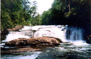 Results of the Coalition efforts towards reaching its goal and the Current Fishery Management Strategy for the Chattooga North Fork
- The Chattooga North Fork is the cleanest (least sedimentation) than any time in my 50 years of fishing it. Most of this was accomplished by closing roads in the Wild and Scenic River corridor and by improving maintenance on other roads in the watershed. Also, the aggressive acquisition program of private lands in the upper watershed by the US Forest Service has reduced sedimentation caused by soil disturbing activities associated with land development activities.
- Headwaters (above Bull Pen Road – 4 miles on Forest Service land) – ‘Wild Trout’ management – artificial lures only. North Carolina stopped the truck stocking of this area, reduced the creel limit, imposed artificial only regulations, and imposed a minimum size. The wild fishery is in good condition and stable.
- Wilderness (Ellicott Rock Wilderness – 5 miles) – ‘Wild Trout’ management. The fishery is stable but well below the quality it was before Wilderness designation. The solitude has been compromised by the high visitation rate attracted by the Wilderness label. The catch rate is lower due to the elimination of the annual helicopter stocking and the increased fishing pressure facilitated by easy access trails. The signage helps. It informs the casual anglers that the area does not have the ‘easy’ stock trout. It applies peer pressure to release the wild trout.
- Burrell’s Ford Area (3/4 mile)– ‘Put and Take’ management w/truck stocking. The fishery is better. Since South Carolina took over the Walhalla hatchery, the ‘put and take’ fishery has improved. Not only are the trout heartier but also the stocking rate is higher, more frequent, and has a higher percentage of larger than average rainbow and brook trout.
- Backcountry (Burrell’s Ford Area to Reed Creek Confluence – 8 miles) – “Put and Grow” management with helicopter stocking of 40,000 sub-adult trout in 22 drops every fall. The results are excellent! The increased numbers of trout provide an excellent catch rate. The rainbows provide a good daytime fishery. The browns provide more ‘hold over’ potential. The fall stocking provides the opportunity for the trout to disperse, grow, and become stream-wise by springtime. The backcountry solitude is outstanding, far better than in the Wilderness. The trail access is excellent for those that backpack in to camp, or for those that walk in or out in the dark with a flashlight. The Coalition is responsible for the restoration of this backcountry fishery resulting in better quality than it was in 1970 (35 years ago).
- Nicholson Fields (Reed Creek to Highway 28 Bridge – 21⁄2 miles) – “Delayed Harvest” management (61⁄2 months of ‘Catch & Release’) with helicopter and truck stocking. The results are Outstanding! A beautiful section of river now has a fishery that far exceeds anything it ever had in the past: high catch rate, larger than average trout, and the opportunity to catch trophy size.
- Long Bottom (below Highway 28 – 2 1⁄2 miles) – “Put and Take” management with truck stocking. The fishery is better for the same reasons described under the Burrell’s Ford Area.
As a result of these accomplishments in water quality, improvements in fishery quality, and the unique backcountry solitude, in 1999 the Chattooga North Fork was named one of the 100 best trout steams in the nation.
The Trout Unlimited Commitment to the Chattooga North Fork
The Coalition has spawned three very active chapters of TU. The Rabun (GA) TU Chapter charted in 1986. The Chattooga (SC) TU Chapter a couple of years later. Then the Foothills (GA) TU Chapter spun off the Rabun Chapter. Even though TU members are not the majority of the Chattooga North Fork backcountry anglers, we are very committed to “giving back” even more to the resource and not just being “resource users.” The TU Councils and Chapters from Georgia and South Carolina have been full partners with the Forest Service and with the DNRs from Georgia and South Carolina in the Chattooga Coalition since the day it was founded in 1985. The Rabun Chapter of TU alone has had over 50 work-outings in the Chattooga watershed under the supervision and direction of Forest Service and DNR personnel. We have participated in activities to collect data, to protect the watershed, and to enhance the trout resources. Rabun TU members alone have contributed hundreds of man-days and over $80,000 in challenge cost-share activities in the watershed.
 Current Concerns
In 1995 the Wilderness Society and Sierra Club identified the Chattooga North Fork backcountry section (between Reed Creek and Burrell’s Ford) as a prime candidate for designation as a Wilderness. This designation would bring to an end the `Put and Grow’ fisheries management with helicopter stocking. The new Forest Management Plans for both Sumter NF and Chattahoochee NF placed this area in “backcountry” prescriptions. The Coalition supported the allocation of the “backcountry” prescriptions to this beautiful wild area.
In 1996, after Lower Chattooga boating reached 80,000 float trips per year, American Whitewater (AW), representing private boaters, began their campaign to remove the “zoning” boating restriction above Highway 28. Private boaters want unrestricted year around access to this last 21 miles of the Chattooga. This includes the headwaters, the Wilderness, the backcountry, and the delayed harvest sections. Prior to the `zoning’ of the Chattooga North Fork as “no-boating” in 1976, conflicts occurred regularly at various locations between anglers and private boaters. Anglers and other existing visitors don’t want user conflicts brought to the Chattooga North Fork. “Zoning” is a proper resource management tool. This whole Forest Service planning process is about “zoning” and protection of the resources, such as solitude. The resource of “solitude” experienced and shared in harmony by the existing visitors to these wild sections should be protected and preserved.
In April 2005, the USFS Washington Office (as a result of an appeal by boaters) instructed the Sumter NF to conduct additional analyses regarding social and natural resource impacts and to involve affected user groups. Until the additional analyses are completed and a revised decision submitted to Washington (which should be in the spring of 2010), management of boating on the Chattooga North Fork above Highway 28 will revert to the direction in the Sumter’s 1985 forest plan, and the closure decision made in that plan will remain in effect. TU, Georgia DNR, and South Carolina DNR support the continuation of the 29-year-old “zoning.” We believe maintaining the “zoning” with no boating above Highway 28 is doing what is the best for the future of our national treasure, the Wild and Scenic Chattooga River.
Starting in 2000 the Forest Service began proposing the paving of the existing 10 mile long Burrell’s Ford Road (BFR). Anglers and other existing user groups do not support the paving of the entire length of the BFR for 3 basic reasons:
Esthetics – The value of forest-based recreation is directly dependent on its contrast with “civilization.” For people who want to “get away,” an unpaved road contrasts markedly with the “paved-over world” of the city.
Resource protection – The Ellicott Rock Wilderness (ERW) resource of “solitude” and the “Scenic” Burrell’s Ford Section riparian zones are already deteriorated by excessive visitation. Complete paving will attract the “Driving for Pleasure” visitors. As a direct result Burrell’s Ford and ERWA visitation will increase and the majority will be the “Picnicking” and”Day Hiking” visitors, not people seeking a solitude experience.
Economic reasons – The first 2.7 miles of paving is estimated to cost over $1.5 million. These funds should be allocated to correcting the worse watershed sedimentation problems first. Anglers do support the partial paving of the critical sections of this 37-year-old road, but not the entire road. The Coalition will not take a position on this issue.
Another concern that began in about 2000 is the loss of the hemlock trees to the hemlock woolly adelgid. This is more than an aesthetic concern. There is the potential for loss of shade canopy to streams throughout the watershed. Before 10 AM and after 4 PM, the hemlocks provided large shaded areas directly to the waters of the Chattooga River. In many riparian areas, the “rhododendron hell” is so thick that replacement trees cannot penetrate through to the sunlight. Prescribed burns, if permitted in the Wild and Scenic Corridor, could “knock back” the rhododendron and allow natural replacement sprouts to get a start.
Monte Seehorn, the Coalition Chairman from day one, sees the need for a vision for the Coalition’s next 20 years. He sees the major concern now is keeping the Coalition focused on the sport fishery in the Chattooga North Fork and keeping the agency managers actively involved in the Coalition’s future. TU must help develop the new plan to guide the Coalition into the next 20 years.
About the Author
Winner of the 2004 TU National Distinguished Service Award, Doug Adams is the editor of Tight Lines, the newsletter of the Rabun Chapter of Trout Unlimited.
In Doug Adams’ words:
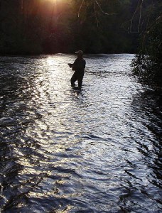
“I consider myself a ‘backcountry trout angler’. I have fly-fished the Chattooga since 1955. I fish the Chattooga North Fork 40 to 60 times each year, usually alone. I will walk in from the road access for 30 minutes to 1 1/2 hours before beginning to fish. I’m seeking a backcountry solitude experience and the challenge of fly-fishing for trout in beautiful environs. The Chattooga North Fork is a special place; it is remote, wild, spectacular, serene, rugged, beautiful, and natural. An area that is rich in Cherokee history. No car horns, no diesel fumes, no cell phones, just the sounds of birds, wind, and water with the aroma of pines and hemlocks. And it has great fly-fishing water with a good variety. The Chattooga experience is the reason my wife and I moved here over 45 years ago. Our children grew up knowing that the Chattooga North Fork is a special place. It is home to the osprey, eagle, bobcat, kingfisher, fox, deer, raccoon, turkey, mink, great blue heron, beaver, bear, otter, trout, and many other wild creatures. And it is also our ‘home river’.”
